|
AMASYA |
City Information
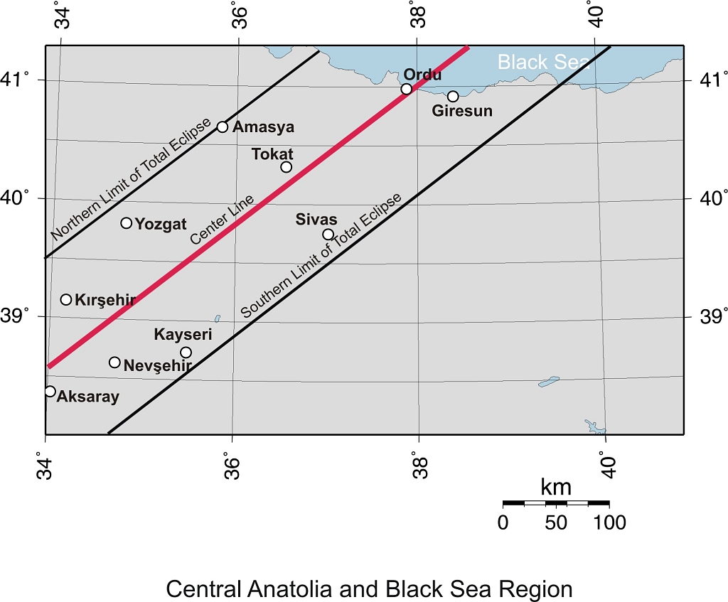
 Amasya is one of
the provinces which is distinct both with its natural setup and historical
values it holds. It was the homeland of the famous geographer Strabo. Located in
a narrow cleft of the Yesilirmak (Iris) river, it has a past of 3000 years
during which many civilizations left priceless remains of their times. The ruins
of the citadel on the rock face of the cleft shelters 2000 year old
water-channels, 1000 year old bridges, a mental hospital, an Ottoman Palace and
a secret underground passageway.
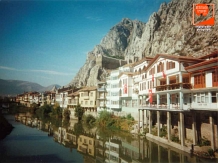
On the rock faces there are impressive rock
tombs of the Pontus kings, which contribute very much to the attractiveness of
the city. At night, when they are illuminated, the view is unforgettable. The
city also has many historically and architecturally precious buildings; the
Ferhat water channel, the 13th-century Seljuk Burmali Mosque, the 15th-century
Amasya is one of
the provinces which is distinct both with its natural setup and historical
values it holds. It was the homeland of the famous geographer Strabo. Located in
a narrow cleft of the Yesilirmak (Iris) river, it has a past of 3000 years
during which many civilizations left priceless remains of their times. The ruins
of the citadel on the rock face of the cleft shelters 2000 year old
water-channels, 1000 year old bridges, a mental hospital, an Ottoman Palace and
a secret underground passageway.
On the rock faces there are impressive rock
tombs of the Pontus kings, which contribute very much to the attractiveness of
the city. At night, when they are illuminated, the view is unforgettable. The
city also has many historically and architecturally precious buildings; the
Ferhat water channel, the 13th-century Seljuk Burmali Mosque, the 15th-century
 Yildirim Beyazit Mosque and Complex; the 14th-century Ilhanli Bimarhane Mental
Hospital with lovely reliefs around its portal, the extraordinary octagonal Kapi
Aga Medrese, the Torumtay Mousoleum and the Gok Medrese.
There are traditional
Turkish mansions which have been well-preserved. The 19th-century Hazeranlar
Mansion has been restored perfectly and now it is of great interest with an art
gallery on its first floor and an ethnographical museum on the second. The
Archaeological Museum of Amasya has an interesting collection including the
mummies of the Ilhanli rulers of Amasya. As for natural beauty, Amasya is set
apart from the rest of Anatolia in its tight mountain valley and hides its own
secret beauty. Lake Borabay (65 kms northeast of Amasya) is a crater lake with
an amazing view and fresh air. It is a perfect area for fishing (especially
trout), for picnicking and for being alone with nature. Yedikir Dam Lake and
Omarca National Park are other excursion sites. Terzikoy spa center, a thermal
resort, is also worth a visit.
Yildirim Beyazit Mosque and Complex; the 14th-century Ilhanli Bimarhane Mental
Hospital with lovely reliefs around its portal, the extraordinary octagonal Kapi
Aga Medrese, the Torumtay Mousoleum and the Gok Medrese.
There are traditional
Turkish mansions which have been well-preserved. The 19th-century Hazeranlar
Mansion has been restored perfectly and now it is of great interest with an art
gallery on its first floor and an ethnographical museum on the second. The
Archaeological Museum of Amasya has an interesting collection including the
mummies of the Ilhanli rulers of Amasya. As for natural beauty, Amasya is set
apart from the rest of Anatolia in its tight mountain valley and hides its own
secret beauty. Lake Borabay (65 kms northeast of Amasya) is a crater lake with
an amazing view and fresh air. It is a perfect area for fishing (especially
trout), for picnicking and for being alone with nature. Yedikir Dam Lake and
Omarca National Park are other excursion sites. Terzikoy spa center, a thermal
resort, is also worth a visit.
text reference : www.anatolia.com
Local Weather Condition
| Latitude | Longitude | PoR | E | M C | M H | MRF | DwR | PWD | MWS | H T | M Tmax | M Tmin | L T | M T | DwS | DwoS |
|---|---|---|---|---|---|---|---|---|---|---|---|---|---|---|---|---|
| (° ' ) | (° ' ) | (year) | (m) | (0-10) | (%) | (mm) | (m/sn) | (°C) | (°C) | (°C) | (°C) | (°C) | ||||
| 40 39 | 35 50 | 37 | 412 | 6.2 | 66 | 49.3 | 10.1 |
29 |
14.3 | 4.1 | -6.2 | 8.8 | 3.7 | 10.9 |
| PoR : Period of Record (year) | E : Elevation (m) | M C : Mean Cloud (0-10) | M H : Mean Humidity (%) |
| M R F : Mean Rain Fall (mm) | DwR : Days with rain | PWD : Prevail wind direction | MWS : Mean wind speed (m/sn) |
| H T : Highest T (°C) | M Tmax : Mean Tmax (°C) | M Tmin : Mean Tmin (°C) | L T : Lowest T (°C) |
| M T : Mean T (°C) | DwS : Days with Sun | DwoS : Days without Sun |
![]()